Why This Matters
• Summer storms arrive May 1–2: The Thailand Meteorological Department forecasts scattered thundershowers and isolated storms across Thailand's northern, northeastern, and central regions through May 2, with potential wind gusts and localized flooding.
• Heat peaks before storms: Daytime temperatures between 32–40°C will precede afternoon convection, with highest readings in central provinces.
• Temporary disruption window: This weather pattern is transitional; conditions stabilize after May 2–3 as the air mass shifts.
Thailand's meteorological outlook for May 1–2 reflects typical seasonal weather patterns as the country transitions between the hot season and approaching monsoon. The Thailand Meteorological Department has issued advisories for scattered thundershowers and isolated storms, particularly across the northern, northeastern, and central plains regions. For residents and farmers, the forecast requires practical awareness of timing, regional variation, and basic safety precautions.
The Forecast Pattern
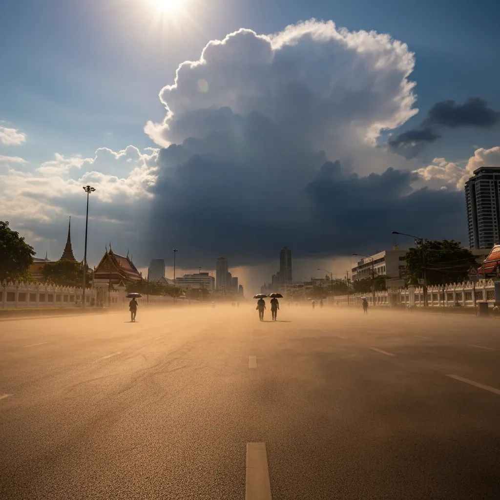
High-pressure systems currently positioned over Southeast Asia are creating atmospheric conditions favorable to afternoon convection. Daytime temperatures will range between 32–40°C across affected zones, with the hottest readings concentrated in central provinces like Nakhon Sawan and Lopburi. Wind patterns will flow predominantly from southerly and easterly directions at 5–30 km/h depending on location.
The Thailand Meteorological Department projects scattered thundershowers will dominate the Northeast, with isolated thundershowers across northern and central areas. This pattern is expected to weaken after May 2 as the upper-level system shifts.
Regional specifics:
• Northeast: Scattered thundershowers likely in provinces including Nakhon Ratchasima, Buri Ram, Surin, and Si Sa Ket
• Central plains: Isolated to scattered thundershowers in Nakhon Sawan, Lopburi, Kanchanaburi, and Ratchaburi; Bangkok expects isolated showers
• North: Scattered afternoon showers in Chiang Mai, Phitsanulok, and Mae Hong Son
• Eastern seaboard and South: Lighter storm activity; coastal areas should anticipate wind gusts on waters
Practical Impacts: Agriculture and Urban Areas
For farmers: The timing coincides with the final phase of hot-season harvesting and early monsoon field preparation. The Thailand Department of Agricultural Extension advises farmers to secure outdoor equipment, clear drainage channels, and be prepared for temporary field inundation if heavy localized rainfall occurs. Livestock owners should ensure animals have adequate shelter and water supplies.
For urban residents: Afternoon peak convection (2–6 PM window) overlaps with rush-hour traffic, creating visibility challenges and potential street flooding in low-lying areas. The Bangkok Metropolitan Electricity Authority (MEA) monitors the grid during storm activity; residents should avoid unnecessary appliance use during severe weather to reduce power surge risks.
For coastal and maritime activities: Fishermen and vessel operators should exercise caution; wave heights may exceed 1 meter in active storm cells. The Thai Meteorological Department recommends remaining in port through May 2 for safety.
Safety Recommendations
Before storms arrive:
• Stock drinking water and non-perishable food
• Charge mobile devices fully for emergency communication
• Clear home drainage systems and gutters
• Secure outdoor objects that could be displaced by wind
• Identify safe routes avoiding flood-prone areas if traveling
During severe weather:
• Remain indoors when possible
• Avoid open spaces, tall isolated trees, and areas beneath unsecured structures or billboards
• If driving, pull to a safe location if visibility drops suddenly due to heavy rain
• Avoid use of electrical appliances during active storms
After storms pass:
• Inspect properties for damage and photograph for documentation
• Report hazardous debris or downed power lines to local authorities via the 1567 hotline (Thailand Center for Disaster Prevention and Mitigation)
• Allow electrical systems time to stabilize before resuming full appliance use
Seasonal Context
This weather pattern is temporary and reflects normal transitional conditions between seasons. By May 3–5, atmospheric instability is forecast to decrease significantly as the upper-level system weakens. The southwest monsoon typically establishes in late May, bringing more consistent wind patterns and more distributed rainfall.
Residents and farmers should treat May 1–2 as a specific weather window requiring basic preparedness—securing outdoor items, monitoring forecasts, and adjusting schedules to account for potential afternoon storms. The disruption is anticipated to be brief and contained.